
MIL-STD-2525E · STANAG APP-6E · 12 Languages
Tactical map & ORBAT editor with MIL-STD-2525E symbology.
Build readable scenario maps with 1,370 standard NATO/APP-6 symbols, tactical control measures, MGRS coordinates, 3D terrain line of sight, and multi-phase PDF/KML/ATAK briefings — with zero accounts or cloud lock-in.
Local-first privacy · 0 accounts · 0 ads · Contact: contact@yelmemap.com
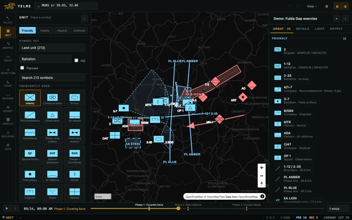
Core Capabilities
Built around doctrine, measurement precision, and clean exports
Every symbol code, tactical label, terrain profile, and ORBAT export stays faithful to open NATO symbology and real WGS84 / MGRS geometry.
1,370 MIL-STD-2525E / APP-6E Symbols
16 automatically extracted symbol sets covering Land Units (213), Control Measures (269), Equipment (223), Facilities (129), Air, Naval, Mine Warfare, Cyber, and Space — across 4 affiliations and 14 echelons.
13 Tactical Control Graphics
Draw Phase Lines (PL), Boundaries with echelon ticks, Line of Departure (LD/LC), Obstacles, Axes of Advance, Engagement Areas (EA), Assembly Areas (AA), Objectives (OBJ), NAI, and TAI.
3D Terrain & Line of Sight (k = 0.13)
Inspect true terrain elevation profiles with Earth curvature and atmospheric refraction correction to verify visible ground vs. dead space corridors.
MGRS, Resection & Range Cards
Measure in MGRS, decimal degrees, or DMS. Compute Polar plots, two-observer Intersections, Resection fixes (degrees or 6400 NATO mils), and export DA Form 5517-inspired sector range cards.
Timeline Phases & Briefings
Animate timed routes across named operational phases and export multi-page A4/A3 PDF decks with task organization tables, KML/KMZ, GeoJSON, and ATAK packages.
OSM Building Fit & Sketch Overlay
Inspect measured OpenStreetMap building dimensions and rubber-sheet real floorplans, evacuation diagrams, or aerial imagery directly onto rotated building footprints.
Actual Application Screens
Designed for iPadOS, iPhone & Desktop briefings
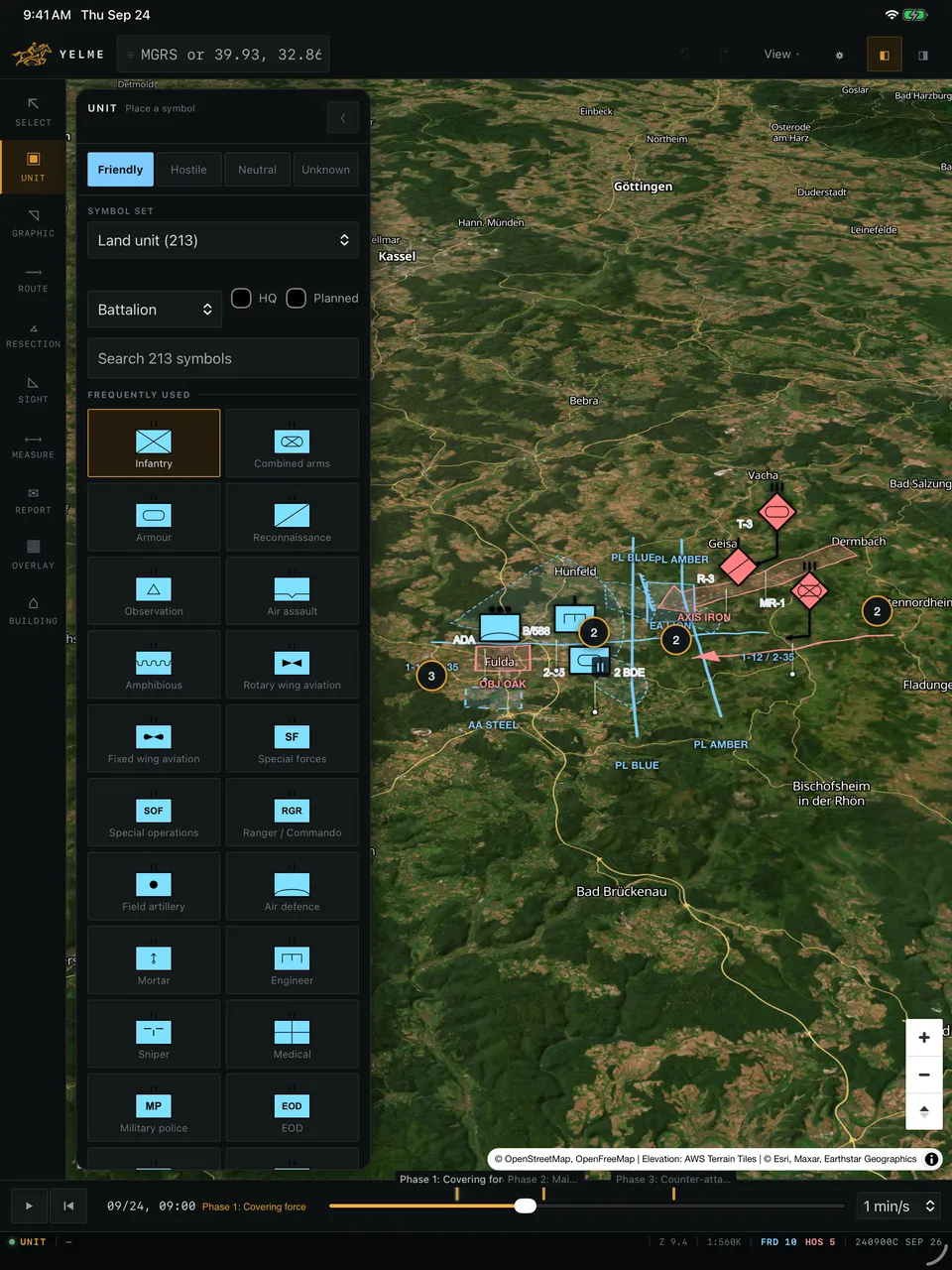
16-Set Symbol Picker
Filter 1,370 symbols across Friendly, Hostile, Neutral, and Unknown affiliations with NATO or Inverse color schemes.
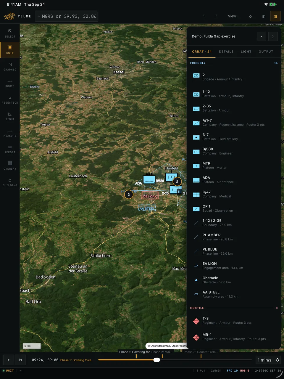
Live ORBAT & Task Org
Review every placed unit, measured boundary, and phase visibility directly alongside your map canvas and multi-page PDF output.
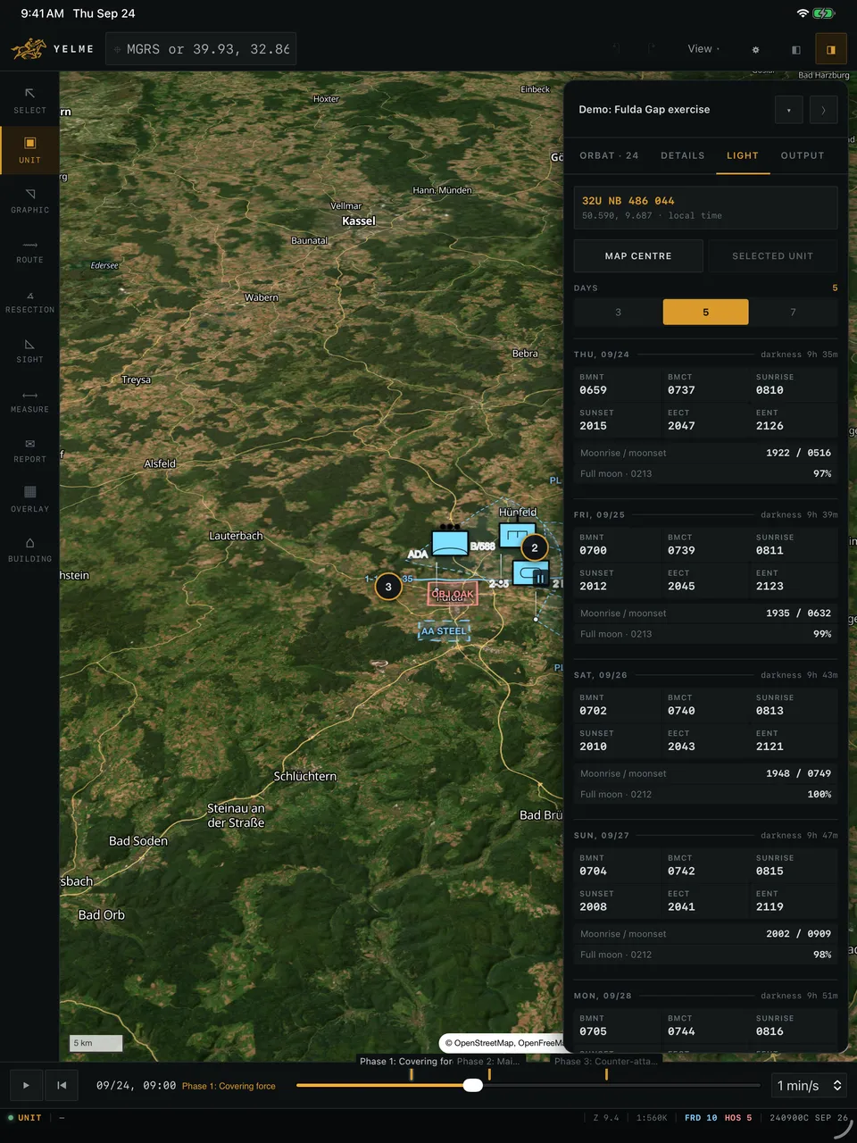
Solar & Lunar Illumination
Inspect BMNT, BMCT, sunrise, sunset, EECT, EENT, and lunar illumination for any map center coordinate or placed unit.
16 MIL-STD-2525E Symbol Sets (1,370 Symbols)
Structured across land, air, sea, subsurface, cyber, space, installations, and tactical control measures.
| Set Code | Category | Symbols | Representative Entities |
|---|---|---|---|
| 25 | Control Measure | 269 | Check point, TRP, action point, release point |
| 15 | Land Equipment | 223 | Armor, artillery, radar, armored personnel carrier |
| 10 | Land Unit | 213 | Infantry, combined arms, armour, recon, mortar, engineer |
| 40 | Activity / Incident | 148 | Arrest, fire, demonstration, patrol incident |
| 20 | Installation | 129 | Airfield, power station, depot, bridge, hospital |
| 30 | Sea Surface | 93 | Frigate, corvette, carrier, amphibious assault ship |
| 60 | Cyberspace | 65 | Combat mission team, cyber protection, threat sensor |
| 36 | Mine Warfare | 59 | Bottom mine, moored mine, minefield sweep area |
Frequently asked questions
What is YELME MAP?
YELME MAP is a local-first tactical map and Order of Battle (ORBAT) editor supporting 1,370 MIL-STD-2525E / STANAG APP-6E symbols across 16 sets, 13 tactical graphics, MGRS coordinates, 3D elevation line-of-sight analysis, and PDF/KML/ATAK briefing exports.
Does YELME MAP require an account or upload my scenarios to the cloud?
No. YELME MAP is designed with local storage privacy, zero accounts, zero ads, and zero behavioral tracking. Scenarios stay on your device unless you explicitly export PDF, PNG, KML/KMZ, GeoJSON, ATAK packages, or a #hash link.
Who is YELME MAP built for?
It is built for training exercises, tabletop planners, wargamers, milsim and airsoft teams, OSINT researchers, and educators who need standard military symbology without heavyweight desktop GIS complexity.
Which platforms and export formats are planned for release?
YELME MAP targets Web, iPadOS/iOS, and desktop environments with exports to A4/A3 multi-phase PDF briefings, high-resolution PNG (1x/2x/3x), KML/KMZ, GeoJSON, ATAK data packages, and time-series WebM animations.
Can I use an MGRS calculator without launching the full map app?
Yes. Our free browser-based MGRS <-> Lat/Lon & UTM converter works standalone with zero login required, alongside a complete searchable breakdown of all 16 MIL-STD-2525E symbol sets.
Join the YELME MAP early access & iOS/Desktop waitlist
Tell us your planning workflow (wargaming, training, milsim, OSINT, or defense education) or test our standalone MGRS utility right now.